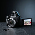
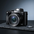
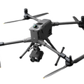
The DJI Zenmuse L3 is DJI's latest LiDAR and RGB survey payload, delivering a 5-return LiDAR system at up to 240,000 points per second alongside a co-axially mounted 20MP RGB camera. Capturing simultaneous LiDAR and photographic data in a single pass, it's built for centimeter-level accuracy in topographic mapping, corridor surveying, forestry analysis, and construction monitoring.
Features
- High-Density LiDAR Performance - Capture rich, clean point clouds with exceptional detail. The L3's upgraded LiDAR engine improves return accuracy, penetration through vegetation, and performance on reflective or uneven surfaces.
- Extended Mapping Range - Map larger areas in fewer flights thanks to significantly improved detection distance and stable accuracy at higher speeds and altitudes.
- Integrated 4K RGB Camera - Colorize your LiDAR data with the built-in 4K camera. Produce vivid true-color point clouds, detailed orthomosaics, and precise visual documentation without needing an external imaging payload.
- Real-Time Point Cloud Preview - View live LiDAR returns in the field for immediate verification. Confirm coverage, adjust mission parameters, and ensure complete data capture before leaving the site.
- Fast, Efficient Workflow - Seamlessly integrates into DJI's end-to-end ecosystem. Data moves easily from flight to processing with support for DJI Terra and major third-party mapping and modeling platforms.
- Rugged, Field-Ready Design - Engineered for harsh environments with improved stability, dust resistance, and consistent performance in challenging lighting or weather conditions.
Specifications
| Spec | Detail |
|---|---|
| LiDAR Returns | 5 returns per pulse |
| Point Rate | Up to 240,000 pts/sec |
| Detection Range | 450 m @ 10% reflectivity |
| RGB Camera | 20 MP 4/3 CMOS, mechanical shutter |
| Accuracy (relative) | 5 cm horizontal / 4 cm vertical |
| Ingress Protection | IP55 |
| Compatible Aircraft | DJI Matrice 400 RTK (also Matrice 300 RTK / 350 RTK per DJI spec) |
| Processing Software | DJI Terra (native), third-party compatible |
Ideal For
- Land surveying & topographic mapping
- Utility & powerline inspection
- Forestry & vegetation analysis
- Construction progress tracking
- Emergency response & public safety
- Digital twins & infrastructure modeling
What's Included
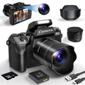
- 1 × DJI Zenmuse L3 LiDAR Gimbal Camera
- 1 × Single Gimbal Connector
- 1 × CFexpress Type-B Card Reader
- 1 × Storage Case
- 1 × Lens Cleaning Cloth
- 1 × Matrice 400 Carrying Case Insert
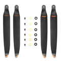
- Screws and Tools
- 4 × Gimbal Damper
- 1 × Lens Cap
Vision Velocity Tech backs every Zenmuse L3 with our standard return and refund coverage. Full policy details, timelines, and eligibility are outlined on our Return and Refund Policy page.
Need help with survey workflows, DJI Terra processing, or a warranty claim? Reach our support team directly.
✉ info@visionvelocitytech.com
🕒 Mon-Fri, 9am-5pm MST
📞 385-612-9388